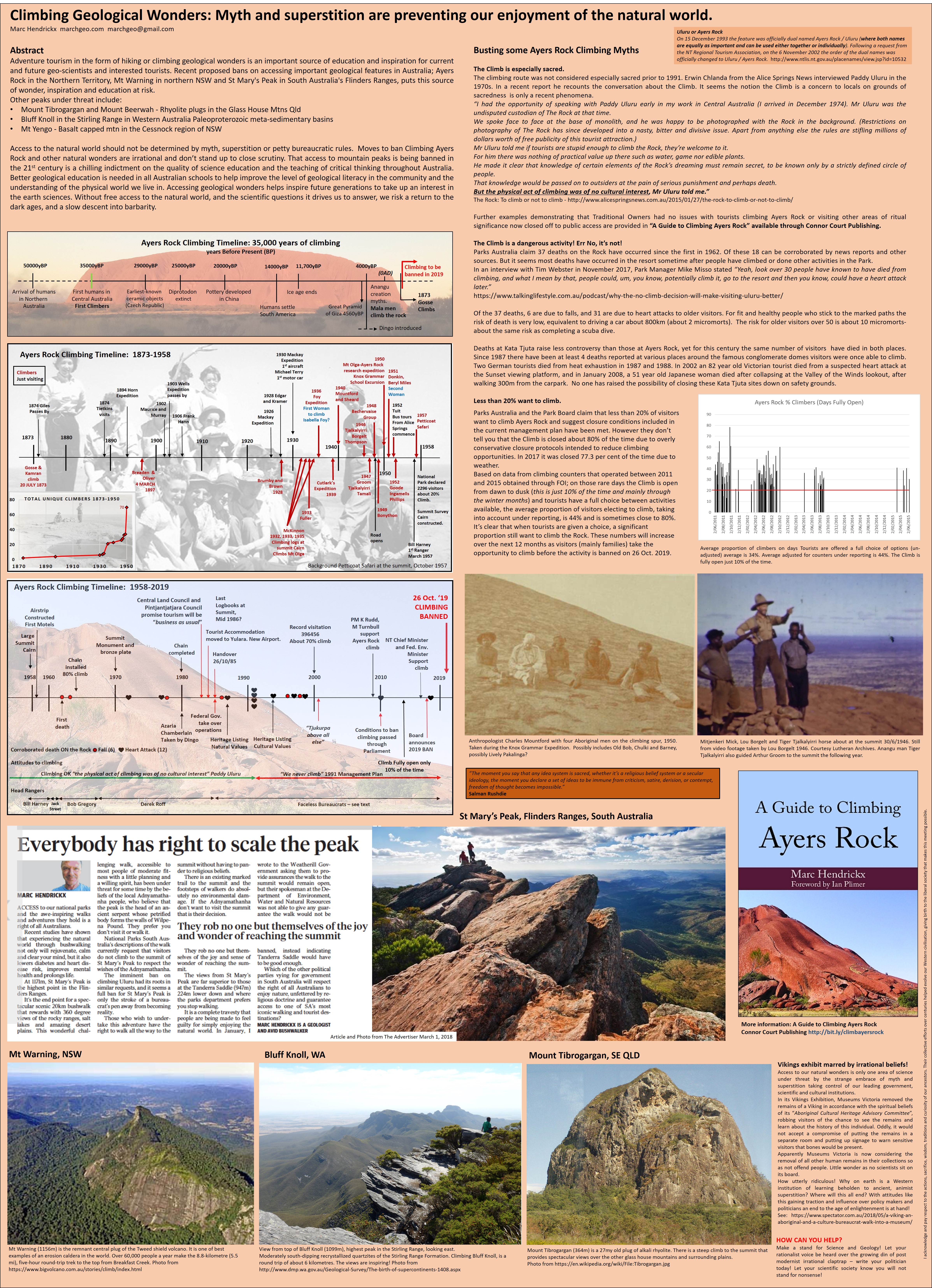
ABC news tonight featured a report on recent Naturally Occurring Asbestos (NOA) issues in NSW. Following a radio interview with Local ABC we thought we would add a few notes.
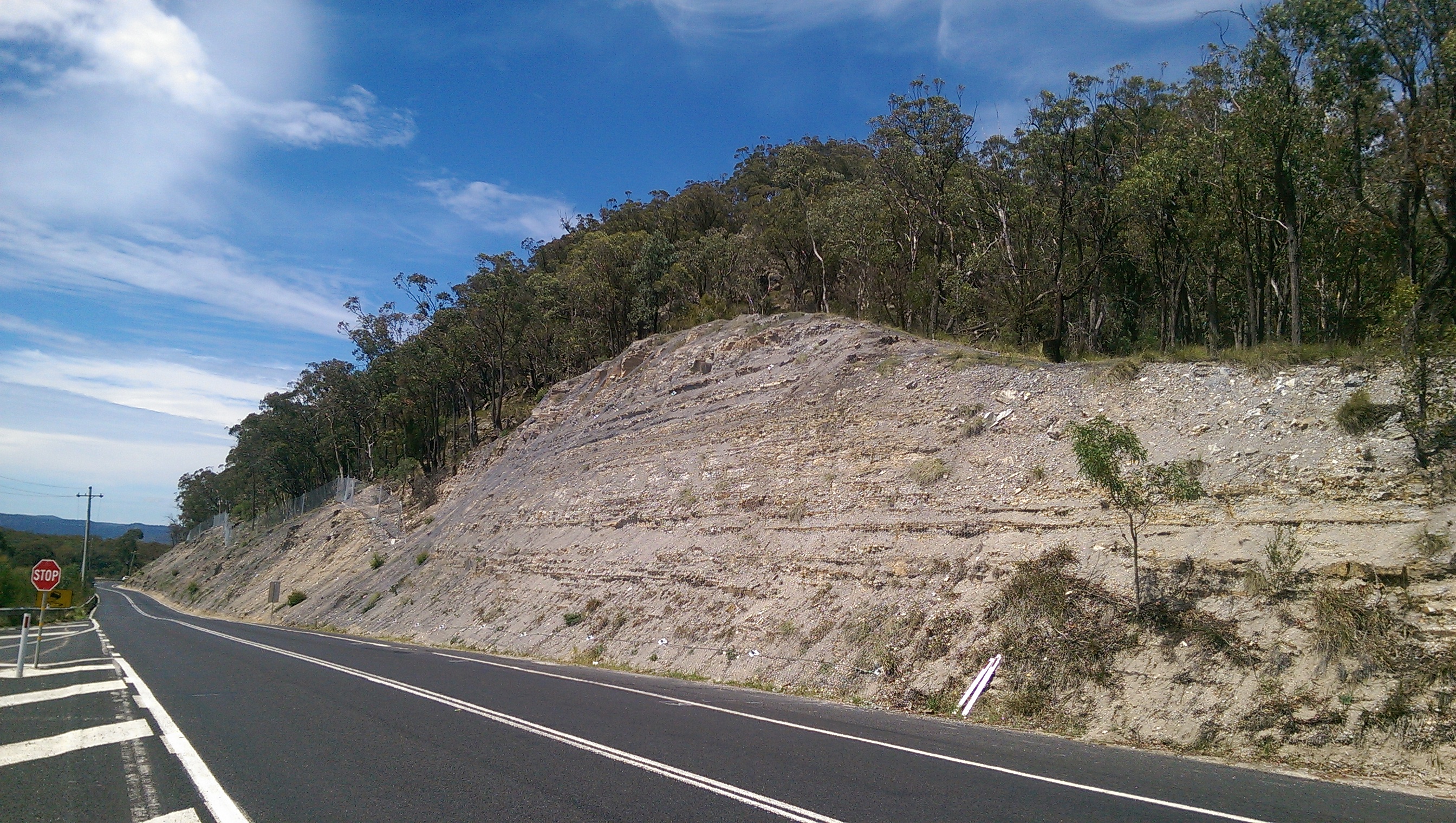
Photo showing asbestiform tremolite in narrow slip fibre vein.
The risks of asbestos exposure from natural sources of asbestiform minerals is generally very LOW. The risk of exposure increases if rocks containing NOA are significantly disturbed. This generally requires pulverising the rock to release respirable fibres. This may take place if NOA bearing rock is crushed to create aggregates, or disturbed during major earthworks, for instance during road construction activities or during mining.
Living next to undisturbed outcrops or walking over, or camping next to rock outcrops containing NOA is not a significant risk. Air quality studies have shown no detectable levels of fibre in such circumstances.
A NOA management plan can reduce the potential for exposure. Key to this is recognition of NOA in the first place. This requires a geological assessment. The Heads of Asbestos Coordination Authorities (HACA) have recently released a map showing NOA potential of rock units in NSW. The map is based on a desktop study and rates rocks as LOW, MEDIUM and HIGH NOA potential. There is no guarantee that rocks in these areas will contain NOA. Only a site visit by an experienced geologist and testing can confirm the presence of NOA. There are some issues with the map, but is of great use in helping to identify areas potentially at risk.
The map may be accessed via a NSW government website. In using this make sure you turn on all the layers. (Click on the layers tab, then click the asbestos drop down -arrow on RHS, then click “STATEWIDE – GEOLOGICAL UNITS WITH ASBESTOS POTENTIAL” and check all the boxes).
In its report ABC make the claim that: “…naturally occurring asbestos (NOA) which is present in about 1 per cent of the state.” This is substantially incorrect. In fact the HACA map report indicates just 0.83% of NSW of outcropping units have been assigned a NOA potential. This is a potential, NOT an actual occurrence. There are only a small number of known NOA occurrences, and only a few historical asbestos mines in NSW, the largest of which was the Woodsreef mine in northern NSW. The map is an assessment of the geological potential based on geological factors such geochemistry and metamorphic and structural history. Of the 0.83%; 0.56% is LOW potential, 0.16% is MEDIUM potential and just 0.11% is HIGH potential. For the HIGH potential areas, which are the main problem, only a very small percentage of the rock (typically <1%) is likely to contain any asbestiform minerals. NOA occurrence in LOW and MEDIUM potential areas is contentious and in many cases field inspection and detailed geological assessment indicates the classification is not warranted.
ABC state “The risk posed by NOA is similar to when it is in its bonded form, such as building materials.” This is not true. Manufactured Asbestos Products (MAPs) contain asbestos fibres that have already been processed from the host rock. Hence asbestos products, like asbestos cement sheeting, already contain fibres that are of respirable dimensions. It only takes minor disturbance to liberate respirable fibres from MAPs. Rocks containing asbestiform minerals bound to the rock generally require substantial disturbance to release fibres and more disturbance to produce fibres that are respirable.
Further information is available through our NOA page. See also the material on the SAFEWORK NSW website.
The conclusions of Marc’s 2010 Masters thesis worth repeating…
Thesis Conclusions
Based on knowledge of the geology of asbestos in Australia and medical studies that have established NOA as a source of exposure elsewhere, the risks to the general population in eastern and South Australia from exposure to fibres from natural sources is negligible. Only those outcrops close to human settlements that have undergone significant long term anthropogenic disturbance through mining, quarrying, excavation or repeated disturbance through ploughing are considered a risk of releasing fibres in quantities large enough to be considered a significant health risk. In eastern and South Australia, such outcrops are generally in areas of low population density. Rocks containing asbestos that have not been disturbed are probably not a significant source of asbestos fibre. For such outcrops there is no mechanism that can release individual fibres in sufficient quantities and size that would make them bio-available. A key factor is that if asbestos is not disturbed and fibres are not released then it is not a health risk.
The overall message about the risks of NOA in eastern and South Australia can therefore be summed up as “No need for alarm”.
Government authorities should take similar precautions to reduce the risks of exposure for all forms of asbestos regardless of the source. In areas where potential asbestos-bearing rocks and soil occur, planning authorities need to seek additional geological and geotechnical advice to reduce the likelihood of unplanned disturbance of asbestos-bearing materials. With engineering controls in place there is a safe means of working in these environments.
The derivative geological maps and associate information produced in this thesis provide a means for non-geologists in planning positions in local, state and federal governments to properly manage development in areas of natural asbestos-bearing materials thereby avoiding future accidental disturbance of NOA.
If you have any questions about NOA, particularly those geological in nature please contact Marc on 0406320248.